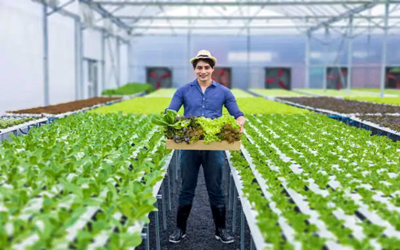
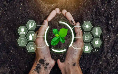
Precision Agriculture and Smart Farming:
Precision Agriculture and Smart Farming: Precision agriculture and smart farming represent an evolution in agricultural practices, using advanced technology and data-driven approaches to optimize crop production and resource management. These methods aim to make farming more efficient, sustainable, and productive by leveraging tools like Geographic Information Systems (GIS), GPS, remote sensing, drones, IoT sensors, and data analytics. Here's a detailed explanation of the key components involved: ________________________________________ 1. Introduction to Precision Agriculture • Definition and Overview: Precision agriculture refers to the practice of managing fields more precisely by using technology and data. It focuses on observing, measuring, and responding to variability in crops, soil, and environmental conditions within a farm field. It enables farmers to optimize inputs (like water, fertilizer, and pesticides) and maximize yield while minimizing environmental impact. • Objectives: The primary goals are to increase productivity, improve crop quality, enhance resource use efficiency, reduce production costs, and ensure environmental sustainability. • Benefits: Benefits of precision agriculture include improved crop yields, reduced input costs, better soil management, and the ability to adapt quickly to changes in weather or soil conditions. • Historical Evolution: Precision agriculture emerged in the 1990s with the integration of GPS and GIS technologies, and has since expanded to include various advanced tools like IoT, machine learning, and robotics. ________________________________________ 2. Geographic Information Systems (GIS) in Agriculture • Role of GIS: GIS is a powerful tool that allows for mapping and analyzing spatial data. In agriculture, it is used to visualize field variability, monitor crop health, and analyze environmental data like soil moisture, topography, and climate conditions. • Applications: o Field Mapping: GIS is used to create detailed maps of farmland, identifying variations in soil properties, topography, and moisture levels. o Crop Monitoring: It helps in monitoring crop growth patterns, identifying stressed areas, and guiding management decisions. o Soil Analysis: GIS assists in soil mapping and analysis, helping farmers understand the distribution of soil types and nutrient levels across their fields. • Benefits: By integrating GIS with other technologies like GPS and remote sensing, farmers can make more informed decisions, such as variable-rate application of fertilizers and water, which ultimately leads to better resource management. ________________________________________ 3. GPS and Remote Sensing Technologies for Farm Management • GPS in Agriculture: o Guidance Systems: GPS-based guidance systems are used in tractors and other agricultural machinery for precise planting, harvesting, and application of inputs. This helps in reducing overlap and ensures accuracy, even at night or under poor visibility conditions. o Variable Rate Technology (VRT): GPS helps in applying fertilizers, pesticides, and irrigation water at variable rates according to the needs of different areas within a field, based on data collected about those specific areas. • Remote Sensing: o Satellite and Aerial Imagery: Remote sensing involves using satellites or aircraft to capture images of fields. These images can provide valuable data about crop health, soil moisture, and pest infestations. o Multispectral and Hyperspectral Imaging: These imaging technologies help in identifying plant stress, nutrient levels, and soil conditions that may not be visible to the naked eye. • Benefits: GPS and remote sensing technologies enable precision in farm operations, leading to efficient resource use, reduced waste, and increased productivity. ________________________________________ 4. Drones and Aerial Imaging in Crop Monitoring • Drones in Agriculture: o Crop Scouting: Drones equipped with cameras and sensors are used to scout crops from the air, providing real-time data on crop health, plant count, and growth stages. o Aerial Imaging: Drones can capture high-resolution images and videos of fields, allowing for detailed analysis of plant health, pest and weed infestations, and irrigation patterns. o Spraying Applications: Advanced drones can also be used for precise spraying of pesticides and fertilizers, ensuring targeted applications and reducing chemical use. • Types of Drones: o Fixed-Wing Drones: Suitable for covering large areas and long-distance surveillance. o Multirotor Drones: More versatile for smaller fields and closer inspections. • Benefits: Drones provide quick, accurate, and non-invasive insights into the condition of crops, enabling timely interventions, which can result in increased yield and cost savings. ________________________________________ 5. Use of IoT (Internet of Things) Sensors for Soil and Crop Management • IoT in Agriculture: IoT sensors are deployed in fields to collect real-time data on various environmental parameters such as soil moisture, temperature, pH levels, and crop growth. • Types of IoT Sensors: o Soil Moisture Sensors: Measure soil water content, helping to optimize irrigation and ensure crops receive the right amount of water. o Weather Sensors: Monitor weather conditions like temperature, humidity, and rainfall, allowing farmers to adjust their practices accordingly. o Crop Health Sensors: Measure aspects like leaf moisture, chlorophyll levels, and plant stress indicators. • Smart Irrigation Systems: IoT enables the development of automated irrigation systems that adjust watering schedules based on real-time soil moisture data, leading to significant water savings. • Benefits: IoT sensors provide precise and continuous data, enabling farmers to respond quickly to changes in the environment, improving efficiency and reducing wastage. ________________________________________ 6. Data Analytics for Yield Prediction and Optimization • Role of Data Analytics: Data analytics involves collecting and analyzing large sets of data to extract valuable insights. In precision agriculture, it is used to analyze trends, predict yields, optimize inputs, and identify potential risks. • Applications in Yield Prediction: o Predictive Analytics: Using historical data, weather patterns, and real-time field data, predictive models can forecast yield potential and help farmers make better planning decisions. o Optimization of Inputs: Analytics can be used to determine the most efficient use of fertilizers, water, and pesticides, maximizing crop yields while minimizing costs. o Machine Learning and AI: These technologies enable the development of complex models that can predict pest outbreaks, disease spread, and optimal harvest times. • Benefits: Data analytics allows farmers to make data-driven decisions, improving productivity, reducing input costs, and enhancing overall farm profitability. It also helps in identifying patterns that may not be obvious through manual observation, leading to better farm management strategies. ________________________________________ Conclusion Precision agriculture and smart farming integrate advanced technologies to revolutionize traditional farming practices. They focus on maximizing yields, reducing costs, and promoting sustainability through the efficient use of resources. By leveraging tools like GIS, GPS, drones, IoT sensors, and data analytics, farmers can make informed decisions, respond quickly to environmental changes, and manage their crops more effectively. The future of agriculture lies in these innovative approaches, enabling farmers to meet the increasing demand for food while minimizing the impact on the environment. Precision Agriculture and Smart Farming is designed to equip participants with cutting-edge knowledge and skills in using digital tools, data analytics, and advanced farming technologies to optimize agricultural productivity, resource management, and sustainability. The course focuses on integrating technology into traditional farming practices to meet the growing demands for food security and sustainable agriculture, especially in the context of climate change and population growth. Participants will explore various aspects of precision agriculture, including the use of sensors, GPS, IoT, drones, data analytics, and AI-based systems for monitoring crops, managing soil health, optimizing water usage, and reducing input costs. This course is suitable for agricultural professionals, farmers, agri-tech entrepreneurs, researchers, and anyone interested in the future of farming. ________________________________________ Course Objectives By the end of this course, participants will be able to: 1. Understand the concepts of precision agriculture and smart farming and how they differ from traditional practices. 2. Implement IoT-based monitoring systems to track soil moisture, temperature, and other critical parameters. 3. Use GIS and remote sensing technology for mapping and analyzing field variability. 4. Integrate data analytics and AI for optimizing crop yields and predicting disease outbreaks. 5. Apply drone technology for crop monitoring, spraying, and field assessment. 6. Develop sustainable water management practices through smart irrigation systems. 7. Design precision agriculture strategies tailored to specific crops and regions. 8. Evaluate the economic and environmental benefits of precision farming techniques. ________________________________________ Course Modules The course is structured into 8 comprehensive modules: 1. Module 1: Introduction to Precision Agriculture and Smart Farming o Overview of precision agriculture o Evolution and history of smart farming technologies o Importance of precision agriculture in global food security o Key benefits and challenges 2. Module 2: Internet of Things (IoT) in Agriculture o Understanding IoT and its applications in agriculture o IoT sensors for soil, water, and crop monitoring o Integrating IoT data with cloud computing o Case studies: Smart farms using IoT 3. Module 3: GIS, Remote Sensing, and GPS Technologies o Basics of GIS and GPS in agriculture o Mapping soil health and crop conditions o Remote sensing techniques for crop monitoring o Analyzing field variability for targeted interventions 4. Module 4: Data Analytics and AI in Agriculture o Introduction to big data in agriculture o Using AI for predictive analytics in farming o Machine learning for crop disease detection and yield forecasting o Building and analyzing data models for precision agriculture 5. Module 5: Drone Technology for Agriculture o Types of drones and their roles in agriculture o Drones for aerial imaging, spraying, and crop analysis o Regulations and safety considerations for drone use o Practical demonstration: Using drones for field assessment 6. Module 6: Smart Irrigation and Water Management o Fundamentals of smart irrigation systems o Water conservation techniques using sensors and automated systems o Case studies: Precision irrigation in drought-prone areas o Designing smart irrigation solutions for different crops 7. Module 7: Sustainable Farming Practices and Soil Health Management o Importance of soil health in precision agriculture o Using technology for soil sampling and nutrient management o Precision application of fertilizers and pesticides o Sustainable practices for reducing environmental impact 8. Module 8: Economic Analysis and Implementation of Precision Agriculture o Assessing the ROI of precision farming technologies o Developing a business plan for smart farming ventures o Funding and grant opportunities for precision agriculture o Future trends in smart farming and digital agriculture ________________________________________ Students' Expectations By completing this course, students can expect to: • Gain practical skills in using IoT devices, drones, and data analytics for smart farming. • Understand how to implement precision agriculture practices to maximize yield and minimize costs. • Learn to apply sustainable and environmentally-friendly farming methods. • Access industry insights through case studies, guest lectures, and real-world examples. • Be prepared to lead or contribute to precision agriculture projects in their communities or workplaces. ________________________________________ Duration and Time • Duration: 12 weeks (3 months) • Time Commitment: 6 hours per week (2 hours of lectures, 2 hours of hands-on practice, and 2 hours of project work) • Total Hours: 72 hours ________________________________________ Mode of Delivery • Delivery Method: Online o Online Component: Live virtual lectures, pre-recorded video lessons, interactive quizzes, and assignments. o Learning Platform: A dedicated Learning Management System (LMS) for accessing course materials, submitting assignments, and engaging in discussions. • Assessment: Weekly quizzes, hands-on project work, and a final project presentation. ________________________________________ Certificate of Completion Participants who successfully complete the course requirements, including assignments, quizzes, and the final project, will receive a Certificate of Completion in Precision Agriculture and Smart Farming. This certificate recognizes their competency in applying advanced technologies to agricultural practices, making them valuable assets in the agritech sector. ________________________________________ Ideal Candidates for the Course • Farmers and agricultural professionals seeking to modernize their practices. • Agri-tech entrepreneurs and start-ups looking to implement innovative farming solutions. • Government and NGO representatives working in rural development and food security. • Researchers and students with a background in agriculture, environmental sciences, or engineering. ________________________________________ This course on Precision Agriculture and Smart Farming aims to foster a new generation of agricultural leaders who can leverage technology for sustainable farming and food security. By integrating modern tools with traditional knowledge, participants will be empowered to transform their agricultural practices and make a positive impact on global food systems.
English
Last updated
Thu, 07-Nov-2024


