Course description
Here’s a detailed description of the first three key topics
in a hydrogeology course, covering the introduction to hydrogeology, aquifer
types and properties, and groundwater flow.
1. Introduction to Hydrogeology
a. Definition and Scope of Hydrogeology
Hydrogeology is the branch of geology that focuses on the
study of groundwater—its distribution, movement, quality, and the interactions
between groundwater and geological formations. It combines principles from
geology, hydrology, and environmental science to understand how groundwater
systems function and how they can be sustainably managed. The scope of
hydrogeology includes:
- Groundwater
Occurrence: Studying where groundwater is found in various geological
settings.
- Hydraulic
Properties: Understanding how water moves through soil and rock.
- Water
Quality Assessment: Analyzing the chemical and physical
characteristics of groundwater.
- Impact
of Human Activities: Evaluating how urbanization, agriculture, and
industrial practices affect groundwater resources.
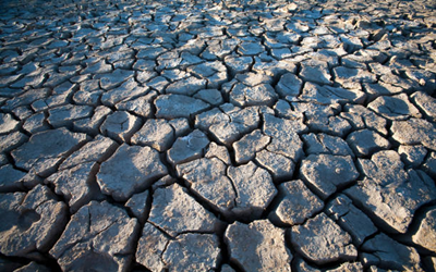
b. Importance of Groundwater in the Hydrological Cycle
Groundwater plays a crucial role in the hydrological cycle,
which describes the continuous movement of water on, above, and below the
Earth's surface. Key points include:
- Storage
Component: Groundwater serves as a significant reservoir of
freshwater, especially in regions with limited surface water sources.
- Recharge
and Discharge: Groundwater is recharged through precipitation,
infiltration, and surface water, and it discharges into rivers, lakes, and
oceans, maintaining these ecosystems.
- Climate
Regulation: Groundwater contributes to maintaining environmental
conditions, influencing local climate and vegetation patterns.
- Human
Use: Groundwater is a primary source of drinking water for billions of
people and supports agricultural and industrial activities.
c. Historical Development of Hydrogeology as a Science
Hydrogeology has evolved over centuries, reflecting
advancements in scientific understanding and technology:
- Early
Observations: Ancient civilizations recognized the importance of water
sources, leading to the development of irrigation and well construction
techniques.
- 19th
Century Advances: The formal study of groundwater began with the work
of hydrogeologists like Henry Darcy, who formulated Darcy’s law, laying
the groundwork for groundwater flow theory.
- 20th
Century Developments: The integration of geology, hydrology, and
engineering principles became more pronounced, leading to advancements in
aquifer testing, modeling, and management practices.
- Modern
Era: Today, hydrogeology is a multidisciplinary field that
incorporates new technologies such as remote sensing, computer modeling,
and geographic information systems (GIS) for comprehensive groundwater
studies.
2. Aquifer Types and Properties
a. Types of Aquifers
Aquifers are geological formations that can store and
transmit water. They are classified into several types:
- Unconfined
Aquifers: These are aquifers that are directly connected to the
surface. They are replenished by precipitation and can easily lose water
through evaporation and surface water drainage. The water table is the
upper surface of the saturated zone.
- Confined
Aquifers: Confined aquifers are surrounded by impermeable layers of
rock or clay, which create pressure. They can store water under pressure,
and when tapped, they may rise above the level of the aquifer, leading to
artesian wells.
- Semi-confined
Aquifers: These aquifers have both permeable and impermeable layers,
allowing some interaction with the surface. They can be recharged from
adjacent unconfined aquifers but are not fully confined.
b. Physical Properties
Understanding the physical properties of aquifers is
critical for evaluating their capacity to store and transmit water:
- Porosity:
The percentage of void spaces in a material, indicating how much water can
be stored. High porosity is essential for effective aquifer storage.
- Permeability:
The ability of a material to transmit water through its pores. High
permeability allows for easier flow of water, while low permeability
restricts it.
- Hydraulic
Conductivity: A measure of how easily water can flow through aquifer
materials, influenced by both porosity and permeability. It is expressed
in units of velocity (e.g., meters per second).
- Specific
Yield: The volume of water that can be extracted from an aquifer under
the influence of gravity, expressed as a fraction of the total volume of
the aquifer material.
c. Aquifer Testing
Aquifer testing is essential for evaluating the hydraulic
properties of aquifers. Common techniques include:
- Pump
Tests: Involves pumping water from a well at a constant rate and
measuring the change in water levels in observation wells. This data helps
determine the aquifer’s transmissivity and storativity.
- Slug
Tests: A quick test where a sudden change in water level is induced by
adding or removing a known volume of water (the “slug”) in a well. The
recovery rate is monitored to assess aquifer properties.
3. Groundwater Flow
a. Hydraulic Principles
Understanding groundwater flow requires a grasp of hydraulic
principles:
- Darcy’s
Law: A fundamental equation governing groundwater flow, stating that
the flow rate through a porous medium is proportional to the hydraulic
gradient and the hydraulic conductivity. Mathematically, it is expressed
as:
Q=K⋅A⋅dHdlQ = K \cdot A \cdot
\frac{dH}{dl}Q=K⋅A⋅dldH
Where QQQ is the discharge, KKK is the hydraulic
conductivity, AAA is the cross-sectional area, and dHdl\frac{dH}{dl}dldH is
the hydraulic gradient.
b. Flow Dynamics
Several factors influence groundwater flow dynamics:
- Hydraulic
Gradients: The slope of the water table or potentiometric surface
drives groundwater flow; water moves from areas of higher hydraulic
potential to lower potential.
- Resistance:
The flow of groundwater is affected by the material through which it
moves. Fine-grained materials (e.g., clay) present greater resistance than
coarse materials (e.g., sand).
c. Groundwater Recharge and Discharge
Understanding recharge and discharge mechanisms is essential
for sustainable groundwater management:
- Recharge:
The process of water infiltrating the ground to replenish aquifers,
primarily through precipitation, surface runoff, and infiltration from
lakes and rivers.
- Discharge:
The release of groundwater into surface water bodies or the atmosphere. This
can occur naturally through springs or artificially through well
extraction.
- Estimation
Methods: Recharge rates can be estimated using water balance
approaches, soil moisture measurements, and simulation models. Discharge
rates are often assessed through gauging stations or flow measurements.
Conclusion
These key topics provide a foundational understanding of
hydrogeology, covering essential concepts related to groundwater systems,
aquifer
characteristics, and flow dynamics. Mastery of these areas
is crucial for evaluating groundwater resources and developing sustainable
management practices to ensure the availability of clean water for future
generations. Here’s a detailed description
of the next three key topics in a hydrogeology course, covering groundwater
quality, groundwater modeling, and hydrogeological mapping.
4. Groundwater Quality
a. Contaminants
Groundwater quality is significantly impacted by various
contaminants, which can be classified into several types:
- Microbial
Contaminants: These include bacteria, viruses, and protozoa that can
originate from sources such as septic systems, agricultural runoff, and
wastewater discharges. Common microbial contaminants include E. coli,
fecal coliforms, and pathogens that pose health risks to humans and
animals.
- Chemical
Contaminants: These are non-biological substances that can degrade
water quality. Sources include:
- Agricultural
Chemicals: Pesticides, herbicides, and fertilizers can leach into
groundwater from agricultural fields.
- Industrial
Discharges: Heavy metals (e.g., lead, mercury, arsenic) and solvents
from industrial processes can contaminate groundwater.
- Mining
Activities: Metal mining and mineral extraction can lead to acid mine
drainage, introducing harmful substances into groundwater.
b. Water Quality Parameters
Monitoring and assessing groundwater quality involves
analyzing various parameters:
- pH:
A measure of acidity or alkalinity in water. Ideal groundwater pH ranges
from 6.5 to 8.5, as extreme values can affect metal solubility and
biological activity.
- Conductivity:
Indicates the water’s ability to conduct electricity, reflecting the
concentration of dissolved ions. Higher conductivity usually indicates
higher concentrations of dissolved salts.
- Turbidity:
A measure of water clarity, indicating the presence of suspended
particles. High turbidity can be caused by sediment runoff, microbial
growth, or organic material.
- Concentrations
of Heavy Metals and Nutrients: Heavy metals (e.g., cadmium, lead,
copper) and nutrients (e.g., nitrates, phosphates) are critical parameters
that can have adverse effects on human health and the environment. High
levels of nitrates, for instance, can cause methemoglobinemia (blue baby
syndrome) in infants.
c. Water Quality Assessment
Assessing groundwater quality involves several key processes:
- Sampling
Methods: Proper sampling techniques are crucial for obtaining
representative groundwater samples. Techniques include:
- Grab
Sampling: Collecting a single sample at a specific time.
- Composite
Sampling: Collecting multiple samples over time to obtain an average
concentration.
- Laboratory
Analysis: Samples are analyzed in laboratories using techniques such
as chromatography, mass spectrometry, and spectrophotometry to quantify
contaminants and assess water quality parameters.
- Data
Interpretation: Analysis results must be interpreted in the context of
local regulations, historical data, and potential health risks to
determine the overall quality and safety of groundwater resources.
5. Groundwater Modeling
a. Numerical Modeling
Groundwater modeling is a vital tool for predicting and
managing groundwater systems:
- Introduction
to Software Tools: Numerical models like MODFLOW are widely used for
simulating groundwater flow. MODFLOW is a modular finite-difference model
developed by the U.S. Geological Survey, capable of simulating
steady-state and transient groundwater flow in various hydrogeological
settings.
- Model
Components: A typical numerical groundwater model includes:
- Grid
Design: Defining the spatial discretization of the study area.
- Boundary
Conditions: Specifying external influences, such as recharge areas
and wells.
- Initial
Conditions: Establishing starting hydraulic heads and other state
variables.
b. Analytical Solutions
Analytical techniques provide simplified approaches for
solving basic groundwater flow problems:
- Basic
Analytical Techniques: These methods, such as Theis solution and
Dupuit-Forchheimer equation, provide approximate solutions to flow
problems, allowing for quick assessments of aquifer performance under
idealized conditions.
- Limitations:
While analytical solutions are useful for simple scenarios, they often
cannot capture the complexity of real-world conditions, necessitating the
use of numerical models for more accurate predictions.
c. Model Calibration and Validation
Ensuring that groundwater models are accurate and reliable
is crucial for effective management:
- Model
Calibration: This process involves adjusting model parameters (e.g.,
hydraulic conductivity, recharge rates) to align simulated results with
observed data (e.g., water levels). Calibration can be done using
techniques such as parameter optimization and sensitivity analysis.
- Model
Validation: After calibration, the model's predictions must be
validated against independent data sets to confirm its reliability.
Validation helps ensure that the model can accurately simulate groundwater
flow under various conditions.
6. Hydrogeological Mapping
a. Mapping Techniques
Effective hydrogeological mapping integrates various data
sources and technologies:
- Use
of GIS: Geographic Information Systems (GIS) are essential for
visualizing, analyzing, and managing spatial data related to groundwater
resources. GIS can help create detailed maps showing aquifer boundaries,
water quality, and recharge areas.
- Remote
Sensing: This technology involves acquiring data from satellite
imagery or aerial surveys to assess surface conditions that influence
groundwater systems. Remote sensing can provide information on land use,
vegetation cover, and hydrological features.
b. Data Integration
Integrating diverse datasets is vital for comprehensive
hydrogeological assessments:
- Combining
Geological Data: Geological maps provide information on subsurface
materials and structures that affect groundwater movement. This data is
crucial for understanding aquifer characteristics.
- Hydrological
Data: Surface water data, including streamflow and precipitation
records, are integrated to assess groundwater recharge rates and identify
interactions between surface and groundwater.
- Water
Quality Data: Incorporating water quality assessments helps identify
contamination sources and inform management strategies for maintaining
groundwater quality.
Conclusion
These topics enhance the understanding of groundwater
quality, modeling, and mapping in hydrogeology, providing essential knowledge
for the sustainable management of groundwater resources. Students equipped with
this knowledge can contribute to effective groundwater management practices,
ensuring clean and reliable water supplies for communities and ecosystems.
Here’s a detailed
overview of groundwater development processes, borehole drilling and maintenance,
pump installations, spring development, and various technologies used in
hydrogeology.
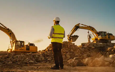
1. Groundwater Development Processes
Groundwater development involves several key steps to
efficiently access and manage underground water resources. The processes include:
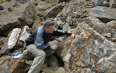
a. Site Assessment
- Hydrogeological
Survey: Analyzing the geology, hydrology, and soil characteristics to
determine groundwater availability and quality.
- Water
Table Mapping: Identifying the depth of the water table and seasonal
fluctuations.
b. Exploration
- Geophysical
Methods: Using techniques like resistivity, seismic, or
electromagnetic surveys to identify potential aquifers.
- Test
Drilling: Conducting preliminary drilling to assess aquifer
characteristics, water yield, and quality.
c. Permitting and Regulations
- Legal
Compliance: Ensuring adherence to local, regional, and national
regulations regarding groundwater extraction.
- Environmental
Impact Assessment: Evaluating the potential effects of groundwater
development on the environment and surrounding ecosystems.
d. Borehole Design and Construction
- Selecting
Drilling Method: Choosing appropriate drilling techniques based on
geological conditions (e.g., rotary drilling, percussion drilling).
- Casing
Installation: Installing casing to prevent collapse and contamination
of the borehole.
- Gravel
Packing: Surrounding the casing with gravel to filter water and
stabilize the well.
2. Borehole Drilling and Maintenance
Borehole drilling is a critical process in groundwater
development, and ongoing maintenance is essential for optimal performance.
a. Drilling Techniques
- Rotary
Drilling: Uses a rotating drill bit and drilling mud to penetrate rock
formations.
- Percussion
Drilling: Involves dropping a heavy weight on the drill bit to break
rock.
b. Borehole Construction
- Depth
Determination: Drilling to the required depth based on aquifer
characteristics and yield requirements.
- Casing
and Sealing: Installing casing to prevent collapse and sealing to
avoid contamination from surface water.
c. Maintenance
- Regular
Inspections: Checking for sediment buildup, corrosion, and signs of
contamination.
- Pump
Testing: Conducting pump tests to evaluate the borehole’s yield and
efficiency.
- Well
Rehabilitation: Cleaning and repairing boreholes to restore water
flow, often through acidization or jetting.
3. Pump Installations
Pumps are essential for extracting groundwater from
boreholes. The installation process includes:
a. Selection of Pump Type
- Submersible
Pumps: Installed underwater, ideal for deep wells.
- Jet
Pumps: Used for shallow wells, relying on suction to draw water.
b. Installation Process
- Site
Preparation: Ensuring a stable surface and adequate space for pump
installation.
- Pump
Positioning: Placing the pump at the correct depth to maximize
efficiency.
- Electrical
and Mechanical Setup: Connecting the pump to the power supply and
ensuring proper mechanical configurations.
c. Testing and Commissioning
- Performance
Testing: Assessing flow rates and efficiency after installation.
- Monitoring:
Continuously observing pump performance to identify any issues.
4. Spring Development
Spring development involves capturing naturally occurring
groundwater that flows to the surface. The process includes:
a. Site Selection
- Hydrological
Assessment: Evaluating potential spring sites based on geological and
hydrological conditions.
b. Spring Capture Techniques
- Spring
Box Construction: Building a structure to collect spring water, often
made of concrete or masonry.
- Piping:
Installing pipes to transport spring water to storage or distribution systems.
c. Protection Measures
- Water
Quality Monitoring: Regular testing for contaminants to ensure safe
drinking water.
- Buffer
Zones: Establishing protected areas around springs to prevent
pollution.
5. Different Technologies in Hydrogeology
Several technologies enhance the understanding and
management of groundwater resources:
a. Groundwater Modeling
- Numerical
Models: Software tools (e.g., MODFLOW) simulate groundwater flow and
predict behavior under various conditions.
- Analytical
Models: Mathematical equations used for simpler systems to assess
groundwater behavior.
b. Geophysical Techniques
- Electrical
Resistivity Tomography (ERT): Mapping subsurface structures by
measuring resistivity variations.
- Ground
Penetrating Radar (GPR): Providing high-resolution images of
subsurface features.
c. Remote Sensing
- Satellite
Imagery: Analyzing land use and vegetation cover to infer groundwater
recharge areas.
- Aerial
Surveys: Using drones and aircraft equipped with sensors to assess
surface water and geological formations.
d. Monitoring Technologies
- Automated
Water Level Sensors: Continuous monitoring of groundwater levels.
- Data
Loggers: Recording data from various sensors for long-term analysis.
e. Water Quality Assessment Tools
- Portable
Water Testing Kits: Allowing for quick analysis of water quality
parameters in the field.
- Laboratory
Analysis: Comprehensive testing of water samples for contaminants and
nutrients.
Conclusion
The processes involved in groundwater development, borehole
drilling, pump installations, spring development, and hydrogeological
technologies are critical for sustainable water resource management.
Understanding these aspects is essential for addressing water supply challenges,
ensuring the availability of safe drinking water, and protecting the
environment. By utilizing advanced technologies and effective management
practices, hydrogeologists can contribute to the sustainable use and
preservation of groundwater resources.